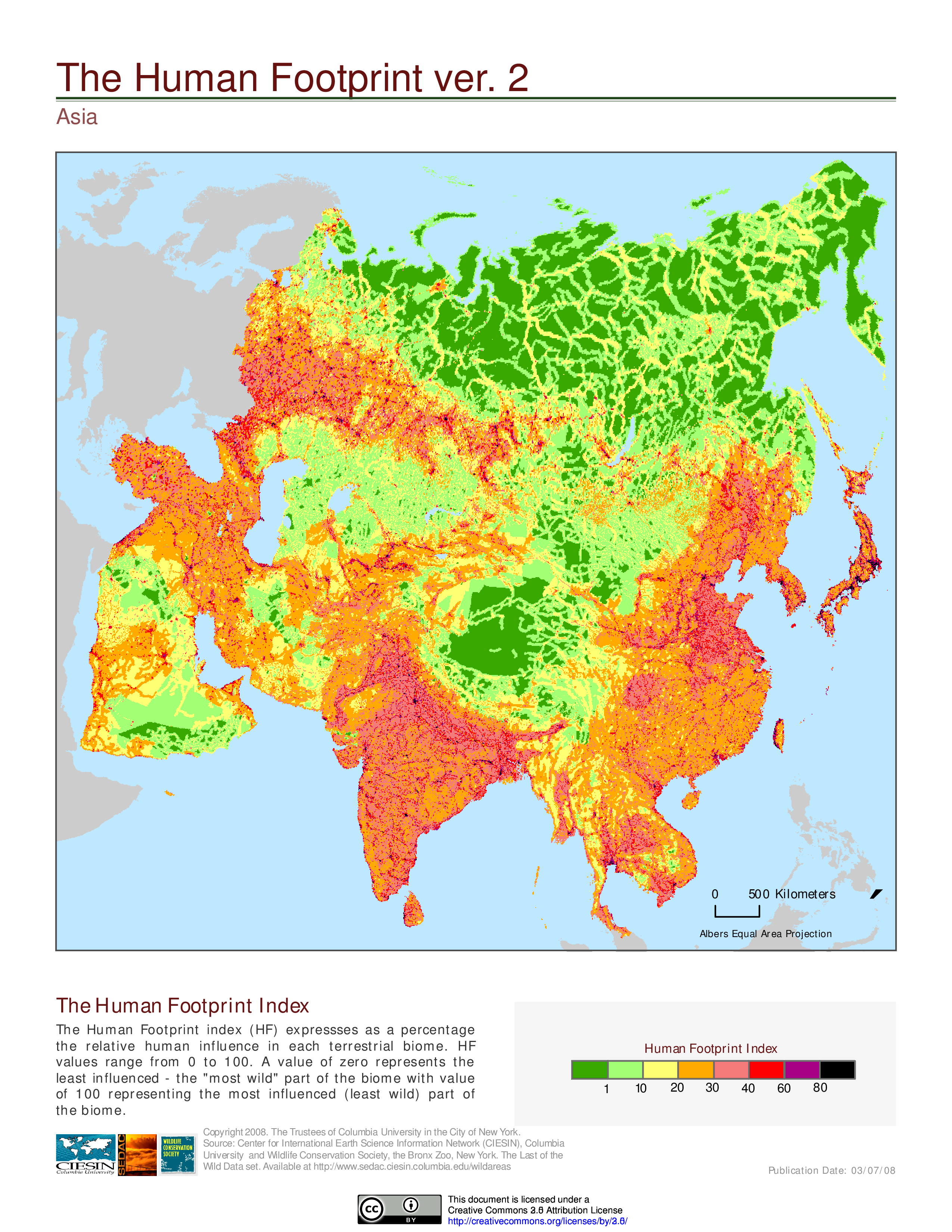
中国冰川资料
边境陆路口岸整理
有趣的地图
人类足迹地图(human footprint index map)
参考网站:http://sedac.ciesin.columbia.edu/data/set/wildareas-v2-human-footprint-geographic/maps
《地缘看世界》图集
藏东南的沟沟坎坎
中国山脉山峰资料
山脉山峰资料
利用echarts制作交互式足迹地图
点击各省可以看省内详细情况。
R中地图相关的包
leaflet
可生成交互式地图,利用openstreetmap数据,也支持多个第三方数据
REmap
基于百度地图的交互式地图
1 | mapNames('西藏') #得到某个地图下的子图信息 |
ggmap
利用谷歌地图快速画静态地图
做图方式类似于ggplot,可以添加多个图层1
2
3
4geocode("Beijing") #获得坐标
mapdist('China Agricultural University','Renmin University of China', 'walking') #获得两地间距离信息
map <- get_map(location = 'China', zoom = 4) #得到地图
ggmap(map)
##
使用Rmarkdown
安装rmarkdown
install.packages("rmarkdown")
安装依赖 (linux平台)
pandoc
获取source1
2
3git clone https://github.com/jgm/pandoc
cd pandoc
git submodule update --init # to fetch the templates
安装Haskell Platform1
curl -sSL https://get.haskellstack.org/ | s
安装pandoc1
2stack setup
stack install
将~/.local/bin添加至path
sublime
sublime text 3的插件设置。